
Banff National Park, nestled in the heart of the Canadian Rockies, is a must-visit destination for nature lovers, adventure seekers, and anyone craving breathtaking mountain views. Getting to Banff National Park is straightforward, with multiple transportation options from major cities like Calgary, Vancouver, Edmonton, and even U.S. hubs like Seattle. The most popular route is driving from Calgary, just 80 miles (128 km) away via the Trans-Canada Highway (Highway 1), taking about 1.5 hours. Alternatively, you can fly into Calgary International Airport (YYC) and rent a car, take a shuttle, or hop on a bus to reach Banff. This guide details the best routes, travel tips, and insider advice to make your journey seamless.
Whether you’re planning a road trip, flying in, or using public transit, this article covers everything you need to know about how to get to Banff National Park from major cities. With detailed driving directions, flight options, shuttle services, and even scenic detours, you’ll find the perfect way to arrive at this UNESCO World Heritage Site. Expect practical lists, easy-to-read tables, and real-world tips to help you navigate like a pro.
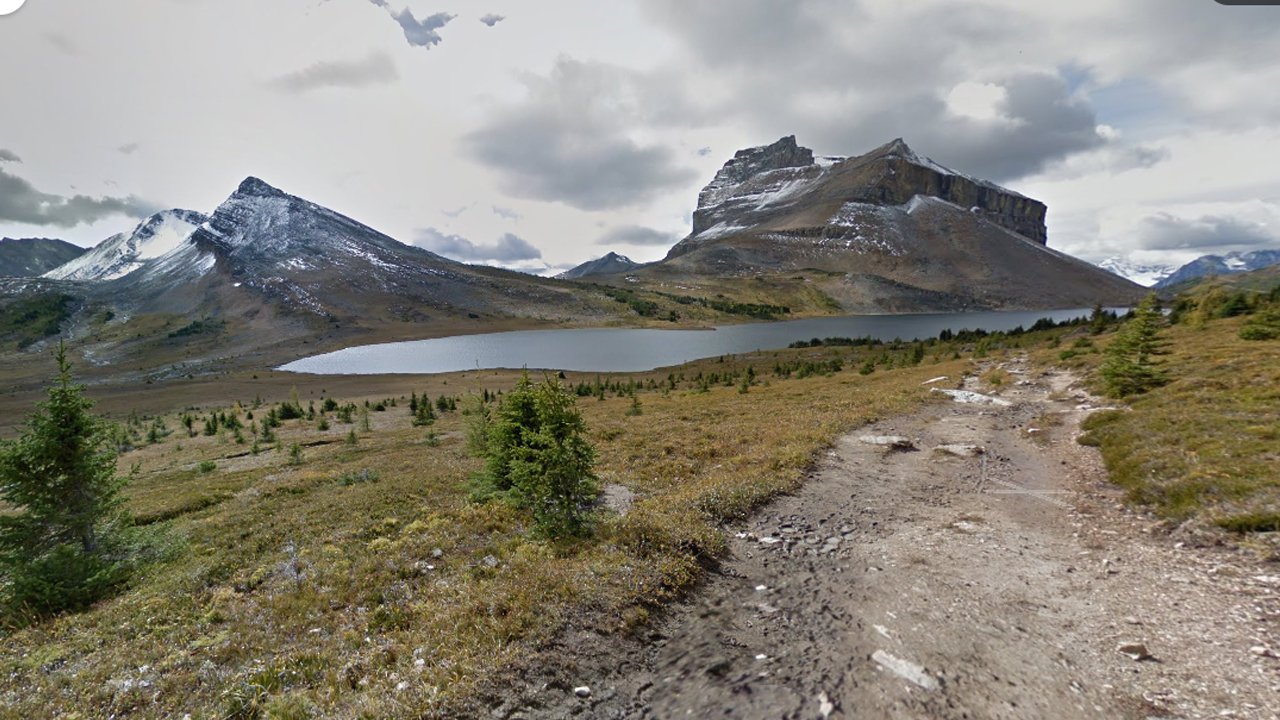
Why Visit Banff National Park?
Before diving into the logistics, let’s talk about why Banff is worth the trip. From turquoise lakes like Lake Louise to hiking trails and wildlife spotting, Banff offers something for everyone. I remember my first drive into the park—jaw-dropping peaks lined the horizon, and I couldn’t wait to explore. Whether you’re visiting for a weekend or a week, getting there is half the adventure. Let’s break down the best ways to arrive.
Driving to Banff National Park: Best Routes from Major Canadian Cities
Driving is the most flexible way to reach Banff, offering stunning views and the freedom to stop along the way. Below, I’ve outlined the top driving routes from key Canadian cities, complete with distances, travel times, and tips for a smooth journey.
Driving from Calgary to Banff National Park
The route from Calgary to Banff is the most popular and straightforward, making it ideal for first-time visitors.
- Distance: 80 miles (128 km)
- Travel Time: ~1.5 hours
- Route: Trans-Canada Highway (Highway 1)
- Highlights:
- Easy, well-maintained highway with clear signage.
- Scenic views of the Rockies as you approach Canmore.
- Stop in Canmore for coffee or a quick hike.
- Tips:
- Check for wildlife crossings—deer and elk are common.
- Winter driving requires snow tires (mandatory November to March).
- Purchase a Parks Canada pass at the park gate or online via Parks Canada.
Calgary to Banff Driving Details
| Aspect | Details |
|---|---|
| Starting Point | Calgary, AB |
| Endpoint | Banff National Park (Banff Town or Lake Louise) |
| Distance | 80 miles (128 km) |
| Average Speed | 90 km/h (Highway 1 speed limit) |
| Rest Stops | Canmore, Bow Valley Provincial Park |
| Road Conditions | Paved, well-maintained; winter snow possible |
| Fuel Stops | Gas stations in Calgary, Canmore, and Banff |
Driving from Vancouver to Banff National Park
For those starting on Canada’s west coast, the drive from Vancouver to Banff is a bucket-list road trip through mountains and valleys.
- Distance: 525 miles (845 km)
- Travel Time: ~9–10 hours
- Route: Trans-Canada Highway (Highway 1) via Kamloops and Revelstoke
- Highlights:
- Pass through Glacier National Park (Canada) for epic scenery.
- Stop in Revelstoke for a quick meal or to stretch your legs.
- Golden offers views of the Kicking Horse River.
- Tips:
- Break the trip into two days for comfort—overnight in Kamloops.
- Watch for construction updates on DriveBC.
- Pack snacks; services are sparse between towns.
Vancouver to Banff Driving Details
| Aspect | Details |
|---|---|
| Starting Point | Vancouver, BC |
| Endpoint | Banff National Park |
| Distance | 525 miles (845 km) |
| Average Speed | 90 km/h (varies with mountain roads) |
| Rest Stops | Kamloops, Revelstoke, Golden |
| Road Conditions | Paved; mountain passes may have snow |
| Fuel Stops | Hope, Kamloops, Revelstoke, Golden |
Driving from Edmonton to Banff National Park
Edmontonians can reach Banff via a scenic route through Jasper National Park, perfect for those wanting to explore more of the Rockies.
- Distance: 255 miles (410 km)
- Travel Time: ~4.5–5 hours
- Route: Yellowhead Highway (Highway 16) to Icefields Parkway (Highway 93)
- Highlights:
- Icefields Parkway is one of the world’s most scenic drives.
- Stop at Athabasca Falls or the Columbia Icefield.
- Jasper offers great photo ops before heading to Banff.
- Tips:
- Start early to enjoy daylight on the Icefields Parkway.
- Cell service is spotty—download offline maps.
- Visit Banff Upper Hot Springs for a relaxing soak after the drive (learn more here).
Edmonton to Banff Driving Details
| Aspect | Details |
|---|---|
| Starting Point | Edmonton, AB |
| Endpoint | Banff National Park |
| Distance | 255 miles (410 km) |
| Average Speed | 90 km/h (slower on Icefields Parkway) |
| Rest Stops | Jasper, Athabasca Falls, Lake Louise |
| Road Conditions | Paved; winter closures possible on Icefields Parkway |
| Fuel Stops | Hinton, Jasper, Lake Louise |
Flying to Banff National Park: Closest Airports and Connections
If driving isn’t your style, flying into a nearby airport and transferring to Banff is a great option. Calgary International Airport (YYC) is the closest, but other hubs like Vancouver or Edmonton work too. Here’s how to make it happen.
Flying from Major Cities to Calgary (YYC)
Calgary is the gateway to Banff, with frequent flights from across North America.
- Cities with Direct Flights:
- Toronto: 4 hours (Air Canada, WestJet)
- Vancouver: 1.5 hours (Air Canada, Flair Airlines)
- Montreal: 4.5 hours (Air Canada)
- Seattle: 1.5 hours (Alaska Airlines)
- Los Angeles: 3 hours (WestJet)
- Transfer Options from YYC:
- Car Rental: Available at YYC from Enterprise, Hertz, and Budget.
- Shuttle Services: Banff Airporter, Brewster Express (~2 hours, $70–$100 CAD one-way).
- Public Bus: On-It Regional Transit (seasonal, ~2 hours, $10–$20 CAD).
- Tips:
- Book flights early for summer or winter peak seasons.
- Check shuttle schedules on Banff Airporter.
- Rent a 4WD vehicle for winter travel.
Flight Times to Calgary (YYC)
| City | Flight Time | Airlines |
|---|---|---|
| Toronto | 4 hours | Air Canada, WestJet |
| Vancouver | 1.5 hours | Air Canada, Flair Airlines |
| Montreal | 4.5 hours | Air Canada |
| Seattle | 1.5 hours | Alaska Airlines |
| Los Angeles | 3 hours | WestJet |
Alternative Airports for Banff
If Calgary flights are pricey, consider these alternatives:
- Edmonton International Airport (YEG):
- Distance to Banff: 280 miles (450 km)
- Transfer: Rent a car or take a Red Arrow bus to Calgary, then transfer.
- Best for: Budget flights from eastern Canada.
- Vancouver International Airport (YVR):
- Distance to Banff: 530 miles (850 km)
- Transfer: Drive or take a connecting flight to Calgary.
- Best for: International travelers from Asia or Australia.
Public Transit and Shuttles to Banff National Park
For those avoiding car rentals, public transit and shuttles are reliable ways to reach Banff. Here’s a breakdown of your options.
Shuttle Services from Calgary
Shuttles are convenient, especially for solo travelers or groups without a car.
- Banff Airporter:
- Frequency: 10+ daily departures
- Cost: $70–$100 CAD one-way
- Drop-off: Banff Town or major hotels
- Brewster Express:
- Frequency: 5–8 daily trips
- Cost: $80–$120 CAD round-trip
- Drop-off: Banff and Lake Louise
- Tips:
- Book in advance for peak seasons (July–August, December–March).
- Shuttles include Wi-Fi and comfy seats—perfect for relaxing.
Public Buses to Banff
Budget-conscious travelers can opt for buses, though they’re less frequent.
- On-It Regional Transit:
- Route: Calgary to Banff (seasonal, May–September)
- Cost: $10–$20 CAD one-way
- Stops: Downtown Calgary, Banff Avenue
- Rider Express:
- Route: Calgary to Canmore/Banff
- Cost: $30–$50 CAD one-way
- Stops: Limited, check schedules.
- Tips:
- Buses are slower than shuttles—plan extra time.
- Check Rider Express for deals.
Pros and Cons of Shuttles vs. Buses
- Shuttles:
- Pros: Frequent, direct, comfortable, hotel drop-offs.
- Cons: Higher cost, less flexibility.
- Buses:
- Pros: Budget-friendly, eco-conscious.
- Cons: Fewer departures, longer travel time.
Crossing the Border: Routes from U.S. Cities
For American travelers, Banff is an accessible international getaway. Here’s how to get there from nearby U.S. cities.
Driving from Seattle to Banff National Park
Seattleites can enjoy a scenic cross-border drive to Banff.
- Distance: 420 miles (675 km)
- Travel Time: ~7.5–8 hours
- Route: I-5 to Highway 1 (Canada) via Abbotsford border crossing
- Highlights:
- Pass through British Columbia’s Fraser Valley.
- Stop in Hope, BC, for a quick meal.
- Cross into Banff via Yoho National Park.
- Tips:
- Bring passports and check border wait times at CBSA.
- Winter driving requires preparation—snow is common.
- Explore Banff’s hot springs routes for a relaxing detour (see more here).
Seattle to Banff Driving Details
| Aspect | Details |
|---|---|
| Starting Point | Seattle, WA |
| Endpoint | Banff National Park |
| Distance | 420 miles (675 km) |
| Average Speed | 90 km/h (slower at border) |
| Rest Stops | Hope, Kamloops, Golden |
| Road Conditions | Paved; winter snow on mountain passes |
| Fuel Stops | Abbotsford, Kamloops, Revelstoke |
Flying from U.S. Cities to Calgary
Direct flights from U.S. hubs make Banff accessible without a long drive.
- Cities with Direct Flights:
- Denver: 2.5 hours (United)
- San Francisco: 2.5 hours (WestJet)
- Chicago: 3.5 hours (Air Canada)
- Transfer from YYC: Same as above—shuttles, buses, or rentals.
- Tips:
- Compare fares on Skyscanner for deals.
- Arrive early to clear Canadian customs.
Scenic Detours and Stops Along the Way
No matter your route, Banff’s surrounding areas offer plenty of opportunities to stretch your legs. Here are some must-visit stops:
- Canmore (from Calgary):
- Why: Charming mountain town with cafes and trails.
- Time: 20 minutes off Highway 1.
- Yoho National Park (from Vancouver or Seattle):
- Why: Emerald Lake and Takakkaw Falls are stunning.
- Time: 30-minute detour from Highway 1.
- Icefields Parkway (from Edmonton):
- Why: Peyto Lake and glacier views are unforgettable.
- Time: Built into the route.
- Tips:
- Pack a camera—photo ops are everywhere.
- Follow safety guidelines at hot springs or trails (check rules here).
Top 5 Scenic Stops Near Banff
- Lake Louise: Iconic turquoise lake, 30 minutes from Banff Town.
- Moraine Lake: Stunning valley views, best at sunrise.
- Peyto Lake: Fox-shaped lake with vibrant colors.
- Johnston Canyon: Easy hike to waterfalls, open year-round.
- Bow Valley Parkway: Quiet road with wildlife sightings.
Tips for a Smooth Journey to Banff
To wrap things up, here are some practical tips to ensure your trip to Banff goes off without a hitch:
- Plan for Weather: Winters are snowy—check forecasts on Environment Canada.
- Book Early: Shuttles, rentals, and flights fill up fast in summer and ski season.
- Pack Smart: Bring layers, hiking boots, and a reusable water bottle.
- Stay Connected: Wi-Fi is spotty in the park—download maps ahead of time.
- Respect Nature: Follow Leave No Trace principles to protect Banff’s beauty.
Banff Travel Checklist
| Item | Details |
|---|---|
| Documents | Passport (for U.S. travelers), Parks Canada pass |
| Clothing | Layers, waterproof jacket, sturdy shoes |
| Gear | Camera, binoculars, reusable water bottle |
| Navigation | Offline maps (Google Maps, Maps.me) |
| Snacks | Granola bars, fruit—services are limited in the park |
Final Thoughts
Getting to Banff National Park is an adventure in itself, whether you’re cruising along the Trans-Canada Highway, flying into Calgary, or crossing the border from the U.S. With routes from cities like Calgary, Vancouver, Edmonton, and Seattle, you’ve got plenty of options to suit your budget and schedule. My first trip to Banff was a spontaneous road trip from Calgary, and I’ll never forget the moment I saw those towering peaks—it felt like stepping into a postcard. Use this guide to plan your journey, and you’ll be exploring Banff’s trails, lakes, and hot springs in no time.